
Since moving to Scotland from England, I have taken the opportunity to explore more of Scotland’s Roman connections as a teacher of Classics, history lover and mother of a lively 7 year old!
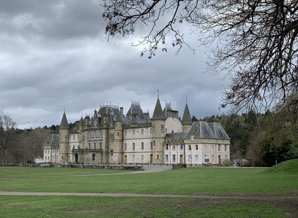
A trip to Callendar House and Park really piqued my interest in the Antonine Wall and its temporary display brought to life what it was like to live on Rome’s final frontier for soldiers from across the Roman Empire, travelling tradespeople and local Caledonians. This beautiful 14th century French chateau styled house sits behind soaring 1960s tower blocks alongside the foundations of part of the 2000 year old Antonine Wall. It is completely free to visit, has a Roman Fort inspired children’s playground and a really fun outdoor natural play trail including the best tandem zip lines for miles around! Packed full of history from across the centuries with a cracking tearoom, it is an absolute hidden gem if you are visiting Falkirk or looking for a fun day out.
The Roman army which consisted of men from legions across the Roman Empire began building the wall in 142 AD and it took 12 years to complete. It is likely that Emperor Antoninus Pius, after whom the wall is named, built the turf wall to gain political and military favour with the Roman people before it was abandoned in AD 160s when the soldiers destroyed the forts and threw anything of value down the numerous fort wells which have helped to preserve some amazing archaeological finds.

At the time the construction finished, the wall stretched all the way from Old Kilpatrick on the River Clyde to the Firth of Forth, about 37 miles! The Rediscovering the Antonine Wall Project has been very successful in bringing local communities and visitors together to explore its history and show how the central belt landscape has evolved around the footprint of the wall.
As a keen runner and hillwalker, I became interested in tracing and walking the route of the wall from west to east and roped in my husband as additional navigational support!
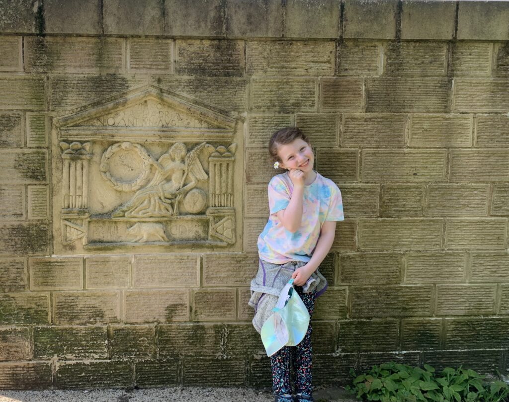
The plan was to walk as close to the original line of the wall as possible in stages until we completed the full 37 miles. Our 7 year old accompanied us for Leg 1 so we decided Old Kilpatrick to Bearsden would be just about manageable. We parked the car at Bearsden station and took two trains to Kilpatrick where we picked up the canal path and found the replica distance slab which marks the western end of the Antonine Wall. Distance stones were placed along the wall to record each section as it was built and the original found nearby is housed in the Hunterian Museum.
Using an OS map, we snaked our way up and along conservation areas, country paths, housing estates, all the time keeping the beautiful Kilpatrick hills to our left.
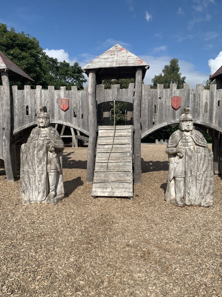
The Village Green in Duntocher, a former site of one of the many forts along the wall, was the perfect place for a picnic lunch and a chance to splash about in the river as it was a surprisingly warm day for bonnie Scotland! We then headed across the road and into Golden Hill park which has one of the five themed Roman fort playparks in the five authorities which the wall crosses.
This was a chance to have a play and check out the beautifully carved Roman legionary soldiers on guard duty! It also has a small section of the original stone foundation of the wall in the park.
We knew fatigue might hit soon with the heat of the day so we swiftly headed down to pick up the pretty country path that ran alongside Clydebank and District golf course. We got a little lost finding Castlehill fort but eventually we saw the round circle of trees at the top of the hill and then turned right to start weaving our way down through the leafy surburban streets of Bearsden. We finally hit Bearsden Cross where we found a cafe and had a well deserved ginger beer before heading back to the car. It was a 7-8 mile round trip.
Stay tuned for Leg 2 from Bearsden to Croy Hill.