
We were very excited to begin Leg 2 of the Antonine Wall – a turf wall built by the Romans in 142 AD which extended 37 miles across Scotland from Old Kilpatrick on the River Clyde to the Firth of Forth.
Having walked from Old Kilpatrick to Bearsden for Leg 1 with our 7 year old, we decided to take advantage of a sleepover offer from the grandparents to get a long stretch in to Croy Hill, which turned out to be 15.5 miles!
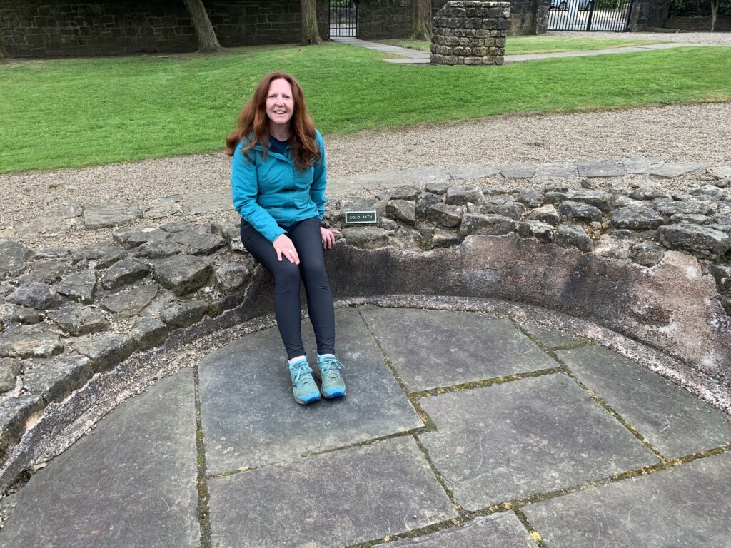
We took the train to Bearsden and walked up to the Cross to pick up the line of the wall along Roman Road. We soon reached the remains of the Roman bath-house which soldiers from the Roman province of Gaul (Modern France) used as a social hub to forget about the fact they had been posted to such a dreich climate! This bath-house was plush; it consisted of hot and cold plunge pools; hot, warm and cold rooms; a sauna and underfloor heating to keep their feet toasty!
The communal cludgie (latrina) can also still be seen just opposite, and microscopic analysis of human sewage found in a defensive ditch nearby showed their diet consisted of mainly vegetarian fare along with imported figs and coriander!
After a plunge in the cold pool, we headed off to New Kilpatrick cemetery where you can still see traces of the stone wall base before reaching Balmuildy Fort across from the River Kelvin. This fort was home to hundreds of Roman soldiers from as far away as modern Syria, Spain, Germany, France, Belgium, the Netherlands, Bulgaria and Northern Africa. These men from the Roman provinces signed up for 25-30 years as auxiliaries, to boost numbers and the skill set of the Roman army, such as the Cretan archers and the Numidian horsemen from North Africa. They received an annual salary, although only a third of a Roman legionary soldier’s, and Roman citizenship on completion of their service. Women and children lived there too: small leather shoes found in excavations are the footprints of soldiers’ families, the results of unofficial marriages with locals. They may have lived in a civilian village outside the fort along with merchants, slaves and bureaucrats.
We continued along Balmuildy Road and crossed into East Dumbartonshire before stopping for lunch on a large green verge looking out at the Campsie Fells! We walked onwards through a small wood and found our way onto the Forth and Clyde Canal. We considered continuing all the way into Kirkintilloch but decided to take the noisier Kirkintilloch Road instead as it was on the line of the wall. Soon signs for Peel Park came into sight and we climbed the hill to a lovely park bench looking out at another Roman fort playpark and the Campsie Fells once again! We hoped to pop into the Auld Kirk Museum but it was closed for lunch so headed into the town centre to grab a coffee, then picked up the canal all the way to Twechar.

Bar Hill loomed in the distance as trees lined the hill going up into the misty clouds. This fort was indeed built at the highest point on the Antonine Wall and when we reached the top, our legs could attest to it! Bar Hill Fort really is the best place to appreciate the strategic importance of the wall, while enjoying sweeping views of the Kelvin valley.
We walked around the fort and saw the foundations of its bath-house, the headquarters building, the fort platform and the east gate. This fort was constructed by XXth Legion Valeria Victrix, the same legion that crushed the Boudica rebellion, arguably viewed as the strongest resistance to Roman rule. Hamian archers from Syria were one of a number of auxiliary regiments garrisoned at Bar Hill. Their bows were crafted from wood, bone and sinew and were superior in both range and power to any other archery set-ups of that era. The Roman legionaries preferred javelins as their choice of projectile weapons and so were keen to utilise the skill and weaponry of these Syrian archers. The Hunterian Museum houses a 3 ft high altar inscribed by a Hamian officer in honour of the pagan god, Silvanus, which was discovered in 1895.
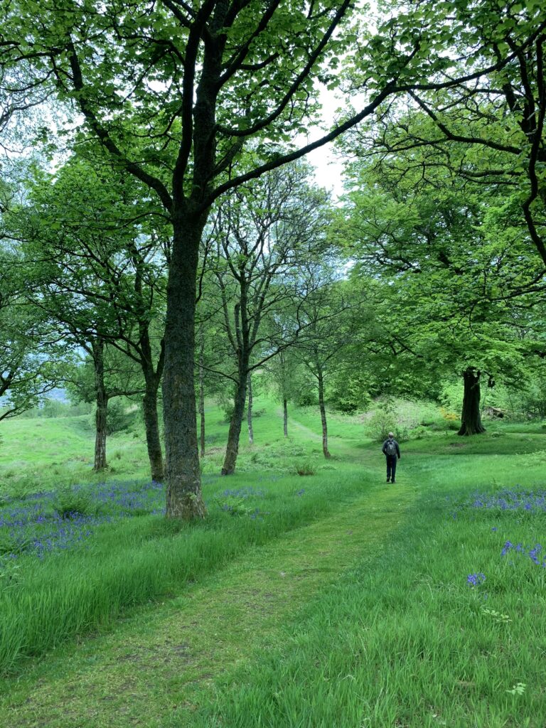
We continued walking through the trees with bluebells bobbing in the light breeze until we reached the Iron Age fort of Castle Hill. The 6th century AD Roman historian, Jordanes, described the locals rather disparagingly as follows: “The inhabitants of Caledonia have reddish hair and large but flaccid bodies. They live in wattled huts, a shelter used in common with their flocks, and often the woods are their home!”

With our legs tiring, we headed down to the town of Croy where 3 iron miners greeted us, a reminder of its industrial past, and headed to the train station. The Roman gods were smiling down on us as the fast train to Glasgow Queen Street pulled into Croy station. We even managed to jump on the fast train at Glasgow Central back to Stewarton before heading home for a well deserved shower and cuppa! How far will we walk on Leg 3, I wonder?