We were very excited to begin our final leg of the Antonine Wall – a turf wall built by the Romans in 142 AD which extended 37 miles across Scotland from Old Kilpatrick on the River Clyde to the Firth of Forth.
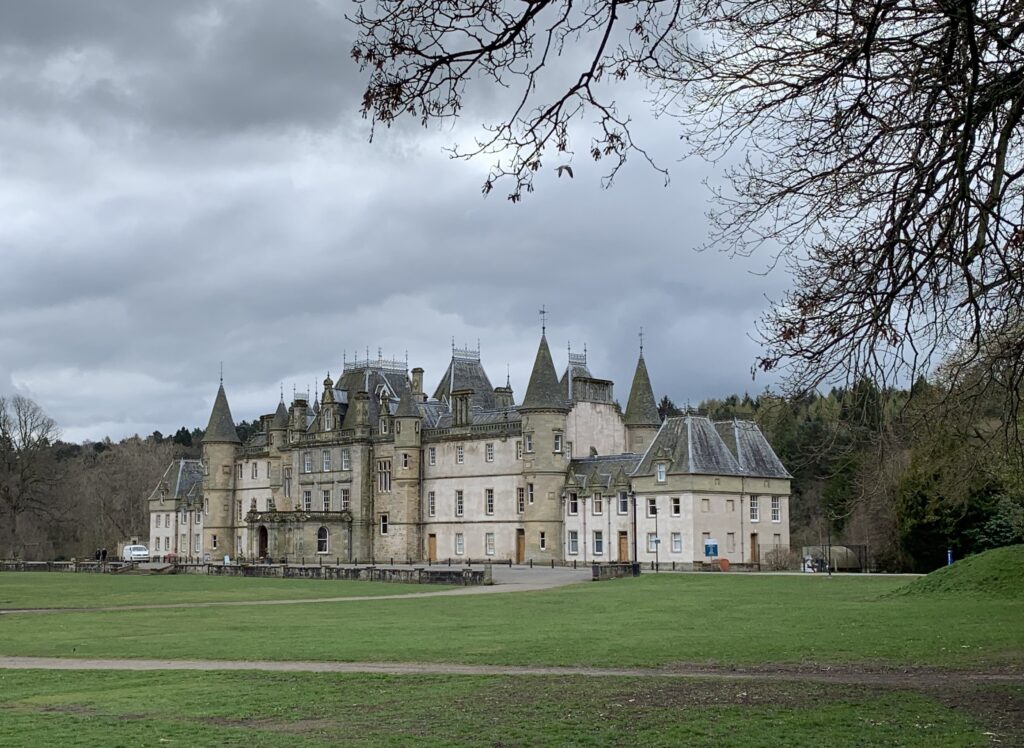
We parked up at Bo’ness opposite the bus station and jumped on the No.2 into Falkirk before alighting in the town centre to pick up the route from Callendar House which had been the inspiration for the walk following their exhibition on Rediscovering the Antonine Wall. It’s a treat for any history lover and also has one of the five Roman themed playparks in its grounds along with a fantastic tea room with views over the park.
As we walked through the towering high risers that stand incongruously near the entrance of this public park, the stunning view of Callendar House suddenly appeared before us. It is easy to see its original impressive driveway which slices through the line of the frontier, supposedly created to allow Queen Victoria to drink in its beauty when her carriage passed by on a visit to Falkirk in 1842! As we continued our walk, we saw a deep dip in the grass which stretched for about a kilometre, evidence of the Roman ditch built on the northern side of the wall.
Soon we headed into Laurieston and walked along Grahamsdyke Street, a popular road name along the frontier meaning “strong wall”, before heading up to Mumrills Road which was the site of the largest fort on the Antonine Wall.
Excavations carried out in the 20th century highlight that this fort, which had held a strategic position, had been dismantled a number of times during the Roman occupation of Britain suggesting that it had originally been built 60 years before the Antonine invasion when Agricola, the Roman governor of Britain had ventured north to put down Caledonian uprisings!
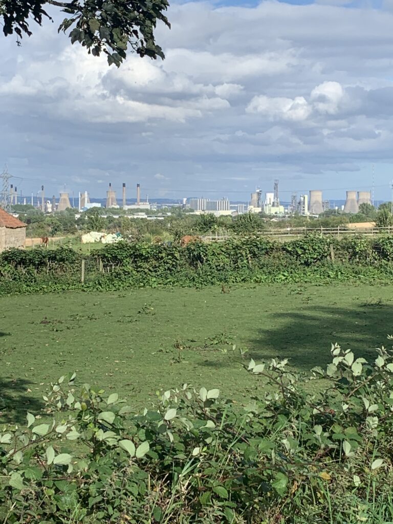
It didn’t seem long before the monstrous site of Grangemouth oil refinery came into view. The sheer size of this refinery is quite something to behold. In 2019, Grangemouth supplied 70% of the fuel to Scotland’s filling stations and it also provides power to the Forties pipeline, which carries oil and gas from the North Sea. However, times are changing quickly and with the extraction and burning of fossil fuels seen as an increasing threat to our environment, we wondered how long this massive complex will become as redundant as the ancient frontier, itself.
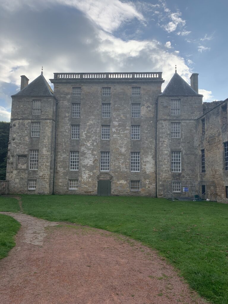
After what seemed like an age, we finally put the oil refinery behind us and headed off onto a back road into the estate of Kinneil House where the remains of its fortlet are just visible. Kinneil House is now looked after by Historic Scotland and is well worth a visit to see its beautiful wall murals that were discovered by chance and which saved this now treasured site from demolition. Indeed, we were informed by one of the guides that, just the day before, King Charles III had paid a visit during his and Queen Camilla’s trip to Edinburgh!
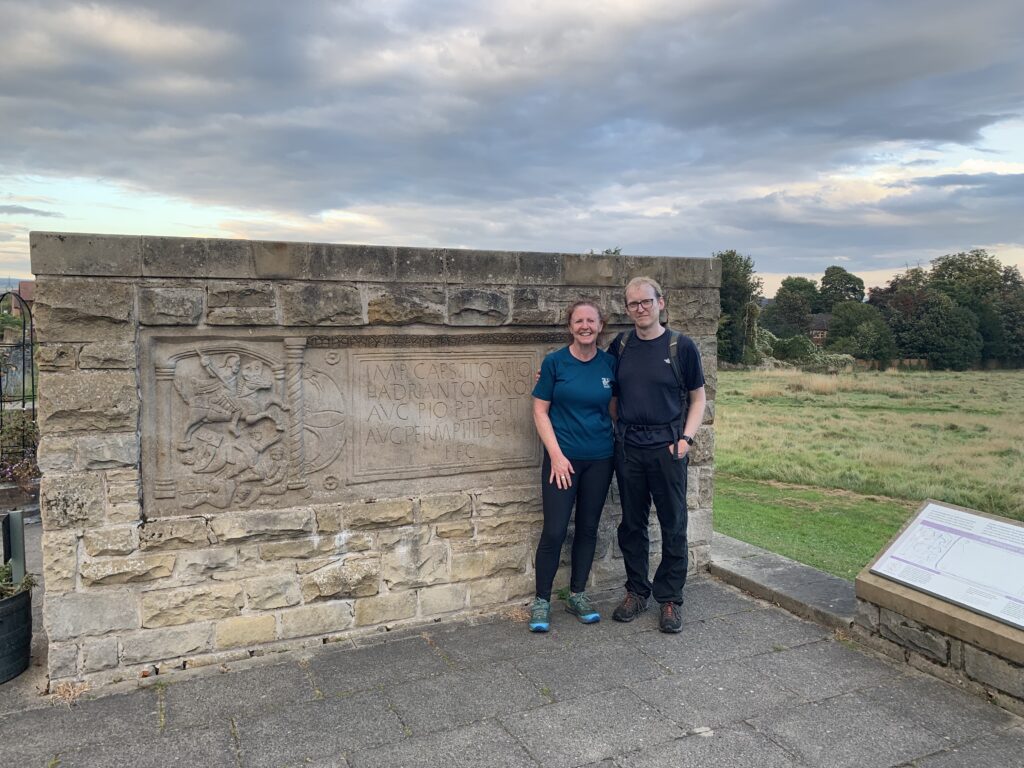
After leaving the estate, we finally headed into Bo’ness to finish our walk at the replica Bridgeness distance slab found in Kinningars Park. The original distance slab that was discovered nearby in 1868 is housed in the National Museum of Scotland in Edinburgh. It is one of at least 18 slabs placed by working squads of legionaries to record the length of Wall they completed. The Bridgeness Slab is particularly striking as it depicts a Roman cavalryman riding down a naked barbarian. The native is shown in four stages of subjugation. At first, he is seen trampled by the horse, but still holding his shield in defiance. Then he is shown disarmed and fleeing with a spear in his back, his shield and sword cast aside. On the right, he is a dejected captive. Finally, in the foreground, he has been beheaded. These distance slabs not only commemorated the physical labour of soldiers from the Second, Sixth and Twentieth Legions but highlight the suffering of those being conquered by a foreign invader.